There was a time, not ancient history but close enough to smell like cassette tapes and gas-station coffee, when a road trip began with a paper map folded wider than the kitchen table. Someone circled towns with a pen. Someone else argued about whether “scenic route” meant “beautiful” or “adds three hours and emotional damage.” And somehow, without a blue dot bossing everyone around, people arrived.
The no-GPS road trip is not about pretending technology is evil. GPS is useful, especially for emergency response, traffic, delivery routes, and avoiding the kind of wrong turn that ends in a gravel driveway guarded by one suspicious goat. But traveling without relying on turn-by-turn navigation can make a trip feel more alive. You notice highway signs. You remember landmarks. You talk to people. You learn that a town with one diner, one water tower, and one overly confident rooster can be more memorable than a perfectly optimized interstate exit.
In a world where phones can tell us how many minutes until the next left turn, the no-GPS road trip asks a better question: What happens when the journey becomes part of the destination again?
What Is a No-GPS Road Trip?
A no-GPS road trip is a drive planned and navigated primarily with analog tools: road atlases, printed maps, written directions, highway numbers, compass awareness, visitor-center brochures, and plain old observation. It does not require smashing your phone with a rock or tossing it dramatically into a lake. Please do not do that. Lakes have suffered enough.
Instead, it means choosing not to let a navigation app make every decision. You can still keep a phone for emergencies, weather alerts, lodging confirmation, and backup navigation. The key difference is that your main guide becomes the landscape itself: signs, mile markers, road names, rivers, mountains, town squares, and the satisfying logic of a well-marked highway.
Why Travel Without GPS?
It Makes You Pay Attention
GPS can be wonderfully convenient, but it can also shrink your world to a glowing rectangle. When you are following spoken commands, you may know what to do next without understanding where you are. A no-GPS road trip forces your brain to build a mental map. You begin noticing that Route 20 runs east-west, that the river stays on your left, and that the old grain elevator means the next town is five minutes away.
Navigation research often discusses cognitive maps, the internal sense of where places are in relation to one another. Heavy dependence on turn-by-turn directions can reduce the need to practice that skill. Reading a map, planning a route, and checking landmarks along the way gives your spatial memory a gentle workout. Think of it as leg day for your hippocampus, except nobody asks you to do burpees.
It Reduces Digital Distraction
Driving safely requires attention. National road-safety guidance consistently warns that distractions include more than texting. Fiddling with a navigation system, adjusting entertainment, eating, or repeatedly checking a screen can all pull attention away from the road. A no-GPS approach helps by moving the planning stage before the driving stage. You study the route, write down key turns, assign a passenger as navigator, and keep the driver focused on driving.
This is not a license to unfold a giant atlas across the steering wheel like a sail. The rule is simple: the driver drives. The passenger navigates. If you are alone and need to check the map, pull over safely. The shoulder of the road is not a reading room, but it is better than trying to decode a county-road grid at 55 miles per hour.
It Turns Mistakes Into Stories
GPS mistakes usually feel annoying because the app promised precision. Analog mistakes feel different. They become part of the trip’s mythology. “Remember when we missed the turn and found that peach stand?” “Remember when we followed the historic byway and accidentally arrived during a bluegrass festival?” “Remember when you insisted north was ‘a vibe’?”
The no-GPS road trip is not about getting lost for sport. It is about leaving room for discovery. Scenic byways, small-town main streets, roadside museums, state parks, old bridges, farm stands, and diners with pie displays the size of architectural models are often missed when the goal is simply the fastest route.
How to Plan a No-GPS Road Trip
1. Start With a Big-Picture Route
Begin with a road atlas or a printed regional map. A road atlas is best for understanding the shape of the journey: major highways, state borders, rivers, mountains, national parks, and alternative routes. If you are traveling through multiple states, mark your start, finish, overnight stops, fuel towns, and major decision points.
For example, if you are driving from Nashville to Santa Fe, you might compare a fast interstate route with a slower path through smaller highways and historic towns. The point is not only “How long will it take?” but also “What kind of trip do we want?” An interstate drive is efficient. A blue-highway drive may be richer, quieter, and more surprising. The trade-off is time, and time is the official currency of good road trips.
2. Choose Your Navigation Tools
A strong no-GPS kit includes a current road atlas, state maps, printed directions, a notebook, a pen, a highlighter, and a small compass. For national parks, forests, or hiking detours, add official park maps or topographic maps. USGS topographic maps can be useful when terrain matters, while road atlases are better for long-distance driving. In simple terms: the atlas tells you how to cross the state; the topo map tells you why your “short walk” is actually a hill-shaped betrayal.
Visitor centers, state tourism offices, park entrances, ranger stations, and many gas stations still provide useful maps. Some are free, some are cheap, and many are easier to read than a phone screen in bright sun. A folded map also does not run out of battery, demand an update, or suddenly decide you should drive through a cornfield because it found a “faster route.”
3. Write Directions Like a Human
Do not write twenty-seven tiny steps that look like a robot’s grocery list. Write directions in chunks:
- Take US-50 west to Jefferson City.
- Stay on US-50 for roughly 85 miles.
- Watch for signs to the scenic river road after Linn.
- Stop for fuel before entering the longer rural stretch.
- If you reach the state park entrance, you passed the diner by two miles.
Good analog directions combine road numbers, towns, distances, landmarks, and backup clues. Highway signs are built for this. They tell you what road you are on, what town comes next, and how far away it is. Once you learn to read them calmly, they become a conversation with the road.
4. Build in Practical Stops
Every romantic road trip needs unromantic logistics. Mark fuel stops, rest areas, grocery stores, hospitals in remote regions, pet-friendly breaks, and overnight options. In rural areas, do not let the gas tank drift toward empty just because the scenery is pretty. The scenery will not push your car.
A safe rule is to refuel earlier than you think you need to, especially in desert, mountain, or plains regions where services can be far apart. Carry water, snacks, a flashlight, a first-aid kit, jumper cables, a phone charger, reflective triangles or flares, a blanket, and basic tools. Emergency-preparedness guidance often recommends a printed map as part of a car kit because connectivity is not guaranteed everywhere.
How to Navigate Without Panic
Use the “Three Clue” Method
Before each major turn, confirm it with three clues: the road number, the direction, and a landmark or town. For example: “We need US-89 north, toward Page, after the bridge.” If you only have one clue, it is easier to turn too soon. If you have three, you are less likely to be fooled by a similarly named road, a confusing interchange, or your uncle confidently shouting, “This looks right!” from the back seat.
Keep a Running Location Log
In your notebook, jot down the time, town, road, and mileage at major stops. This helps you estimate progress and recover if you miss a turn. A simple log might read: “10:15 a.m., left Springfield, Route 13 south, odometer 42,318.” If you later wonder whether you missed County Road J, your mileage notes can answer faster than a debate.
Use Landmarks Like Anchors
Rivers, railroad tracks, ridgelines, lakes, downtown squares, water towers, bridges, and major intersections are excellent orientation points. On a map, look for features that run alongside your route. If the river is supposed to stay to your right and it suddenly appears on your left, either the road curved dramatically or you have entered the “let’s pull over and reassess” portion of the program.
Ask Locals, But Ask Clearly
Local directions can be wonderful and chaotic. Someone may say, “Turn where the old school used to be,” which is charming unless the old school is now a parking lot and you are not a historian of county infrastructure. Ask specific questions: “Which road takes us back to Highway 12?” or “How many miles until the next gas station?” Locals often know closures, construction, and shortcuts that no app explains well.
The Best Routes for a No-GPS Mindset
The no-GPS road trip shines on scenic routes. America’s National Scenic Byways and All-American Roads were recognized for qualities such as natural beauty, history, culture, recreation, and archaeology. These routes are not always the fastest, but they reward attention. They invite you to slow down, stop at overlooks, read historical markers, and let the road tell a story.
Classic no-GPS-friendly drives include coastal highways, river roads, desert loops, mountain passes, historic routes, and state-park corridors. A trip along the Blue Ridge Parkway, a stretch of Route 66, California’s Highway 1, Utah’s scenic byways, or the Great River Road benefits from a map because the route is not merely a line. It is a sequence of landscapes, towns, pullouts, and choices.
When You Should Use Backup Technology
No-GPS does not mean no common sense. Use technology when safety requires it. Check weather before crossing mountain passes. Look up wildfire closures, flood warnings, ferry schedules, park alerts, and construction advisories before leaving. Keep your phone charged and accessible in an emergency. Download offline maps if you are traveling in areas with limited service, even if you do not plan to use them unless needed.
The smartest no-GPS traveler is not anti-technology. They are technology-independent. That difference matters. A person who can read a map, understand highway signs, and make calm route decisions is less vulnerable when the signal drops, the phone overheats, or the app confidently announces a turn onto a road that appears to be made of mud, regret, and cattle tracks.
Road Trip Safety Still Comes First
Before leaving, inspect the vehicle. Check tire pressure and tread, lights, oil, coolant, wipers, brakes, battery condition, and spare-tire tools. Long drives magnify small problems. A weak battery that behaves politely in town may become a full theatrical production in a motel parking lot three states away.
Plan driver shifts if traveling with others. Fatigue can be as dangerous as distraction. Stop regularly, stretch, hydrate, and avoid pushing through exhaustion just to “make good time.” Good time is not good if everyone arrives cranky, stiff, and speaking only in snack crumbs.
Seat belts, speed limits, wildlife warnings, school zones, and weather conditions still matter. In national parks and scenic areas, slow driving is not just polite; it is often necessary. Wildlife, cyclists, pedestrians, sharp curves, and sudden scenic pullouts require patience. The view is better when you are not trying to experience it at the speed of a weather alert.
What You Gain From Getting Unplugged
The greatest benefit of a no-GPS road trip is not nostalgia. It is presence. Without a device narrating every move, you begin making decisions together. The passenger becomes a navigator, not just a playlist manager. Kids learn to follow mile markers. Friends argue cheerfully over whether the thin gray road is “probably fine.” Couples discover whether their relationship can survive folding a map. This is advanced intimacy.
You also become more flexible. Instead of obeying the fastest route, you can choose the most interesting one. Maybe you detour to a state park because the map shows a lake. Maybe you stop in a town because the courthouse square looks lively. Maybe you take the old highway that runs parallel to the interstate and find a bakery, a mural, a record store, or a roadside attraction shaped like a dinosaur wearing sunglasses. GPS would never understand the importance of that dinosaur.
A 500-Word Experience Section: What a No-GPS Road Trip Feels Like
The first hour of a no-GPS road trip feels slightly rebellious, like ordering breakfast for dinner or using the good towels. You pull away with a folded map on the passenger seat, a handwritten route in the cup holder, and the strange realization that nobody is about to say, “In 800 feet, turn right.” The silence is odd at first. Then it becomes pleasant. The road signs start speaking in their quiet green-and-white language. West. Junction. Historic District. Next Services 42 Miles. Suddenly, the drive is not a video game. It is a landscape.
On one analog-style trip through the American Southwest, the most useful tool was not the phone. It was a state highway map marked with a yellow highlighter and coffee rings. The plan was simple: stay on the main highway until the red-rock loop, stop for fuel in the last reliable town, then follow park signs toward the overlook. Nothing about it was difficult, but it required attention. We watched the sun move. We noticed the road climbing. We saw a sign for a scenic pullout that would have been easy to miss while waiting for an app instruction. At the overlook, everyone got out quietly, partly because the view was enormous and partly because the snacks were in the trunk.
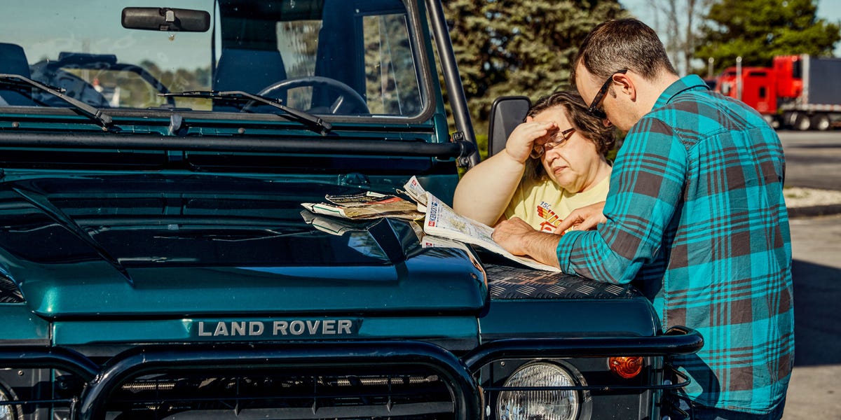
The best moments were not planned. A wrong turn near a small town led to a two-lane road bordered by cottonwoods and old farmhouses. There was no dramatic crisis, just the mild embarrassment of realizing the bridge we wanted was behind us. We pulled into a grocery store parking lot, unfolded the map on the hood, and immediately attracted a local man who asked, “Where are you trying to get to?” Within three minutes, he had explained the correct road, the better road, and the road we should avoid because “it gets weird after the feed mill.” No navigation app has ever said “weird after the feed mill,” which is a shame because that is exactly the kind of information travelers need.
Another time, a paper map saved the mood more than the route. Cell service faded in a hilly region, and the phone map froze in that useless way where it shows your car floating in beige emptiness. Instead of panic, the passenger opened the atlas and found the next town by following the county road grid. We were not lost; we were temporarily under-informed. That distinction matters. Ten minutes later, we reached a main road, found a diner, and celebrated with pie that tasted like competence.
A no-GPS road trip also changes the pace inside the car. Conversations stretch out. People point things out: an old barn, a funny sign, a river bend, a roadside stand selling peaches in baskets. The navigator reads town names aloud. The driver learns the rhythm of route numbers. Even the mistakes feel softer because they belong to the group, not to a machine. You are no longer being delivered. You are traveling.
By the end, the map looks used. Creased corners, pen marks, crumbs, and maybe one suspicious smear of mustard turn it into a souvenir. The trip becomes easier to remember because you helped build it mile by mile. That is the real magic of the no-GPS road trip: it gives the journey back to the people in the car.
Conclusion: The Road Still Knows the Way
The no-GPS road trip is not about rejecting modern convenience. It is about recovering an older skill: paying attention. A map teaches scale. A compass teaches direction. Highway signs teach patience. Small towns teach humility, especially when every local gives directions using buildings that no longer exist.
For travelers who want a richer, slower, more memorable journey, analog navigation offers something a screen cannot: participation. You choose the road. You read the land. You miss a turn, recover, laugh, and find something better than the original plan. Keep the phone for emergencies, but let the map ride shotgun. The blue dot can take a day off. It has been working very hard.
Note: For safety, keep a charged phone, emergency contacts, offline backup maps, water, food, a first-aid kit, and vehicle emergency supplies in the car, even when the main goal is to travel without GPS guidance.